
The United States faces the potential of tornadoes, March 16
A massive storm system that is moving across the United States is expected to bring blizzards to the northern Plains,tornadoes to the Mississippi Valley,and dry windy conditions that increase the risk of wildfires in Texas and Oklahoma on Friday.
![]()
Extreme weather was forecast by the National Weather Service for a large portion of the United States,which has a population of over 100 million. Strong gusts from the Canadian border to Texas were predicted to reach 80 mph (130 kph).
A day after the National Weather Service reported a tornado made landfall in East Los Angeles due to flooding produced by a massive, powerful storm system, the storm system is predicted to send rain to California’s central coast on Friday.
With a high likelihood of tornadoes and destructive winds on Saturday in Mississippi and Alabama, forecasters predict the threat of severe storms will persist into the weekend. Some areas of the East Coast may see flash floods on Sunday due to heavy rainfall.

Such weather extremes are common in March,according to experts,with storm systems bringing violent thunderstorms and tornadoes on the warm side and heavy snow and blizzards on the cold side.
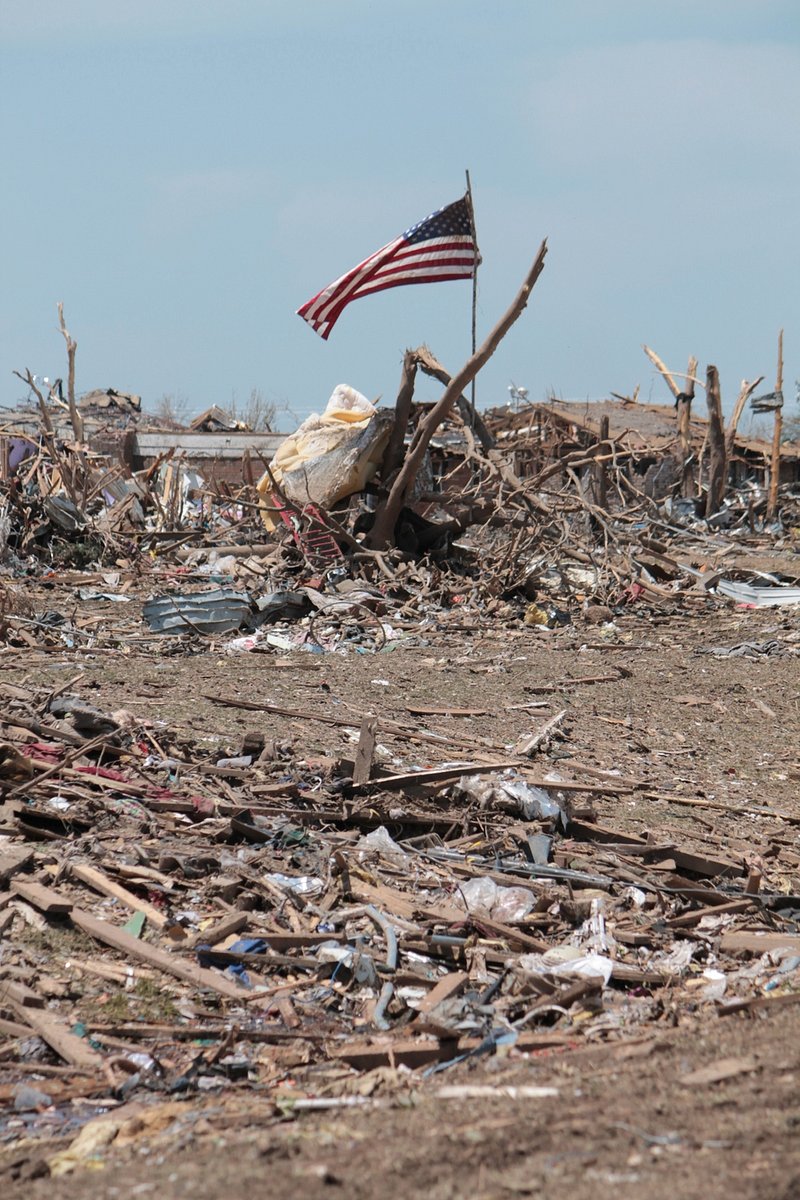
According to Bill Bunting of the meteorological service’s Storm Prediction Center in Norman, Oklahoma,”this one is unique because of its size and intensity. Therefore,that is causing incredibly significant effects across a very wide area.
As a storm develops, tornadoes are likely.
Fast-moving storms could produce baseball-sized hail and tornadoes on Friday,according to the Storm Prediction Center. However,straight-line winds close to or above hurricane force,with some gusts perhaps reaching 100 mph (160 kph), would pose the worst threat.
The regions most at risk,according to forecasters,were eastern Missouri,a large piece of Illinois, and parts of Iowa,Kentucky,Tennessee,Arkansas,and Mississippi. Between Madison,Wisconsin,and Birmingham,Alabama,an estimated 47 million people were at risk of an upgraded to moderately severe storm.
Forecasters became more concerned that severe thunderstorms in the south would probably increase the risk of tornadoes.

According to the Storm Prediction Center, there is a high danger of damaging winds and tornadoes in sections of Alabama, including Birmingham and Tuscaloosa, and Mississippi, including Jackson and Hattiesburg. Eastern Louisiana,western Georgia,and the western Florida Panhandle are all at moderate risk.
We are concerned that tomorrow we may witness severe, destructive tornadoes over the South,Bunting stated.
Governor Kay Ivey of Alabama issued a prophylactic state of emergency on Friday,warning citizens to exercise caution throughout the night and into the weekend.
Also Read : Private shops are experiencing a surge in American spirits under the U.S. liquor prohibition.
There will be blizzards on the Northern Plains.
Travel in some areas of the Northern Plains and Rockies is expected to be dangerous due to strong winds whipping over thick snow,according to forecasters. The Dakotas and Minnesota might experience blizzard conditions.
In mountainous areas of Arizona and Utah,where more than a foot (30 centimeters) of snowfall was anticipated,winter storm warnings that were issued on Thursday persisted into Friday morning. Forecasters issued warnings about slick roads and low visibility. Some sections of Interstate 40 were closed due to snow in northern Arizona.
Earlier in the week,the Sierra Nevada was covered with up to three feet (90 centimeters) of snow,and the winter blast persisted.
Wildfires are “extremely” threatened by dry, windy conditions.
The meteorological service described Friday’s conditions for starting wildfires in the Southern Plains and certain areas of the Southwest as near historic” due to warm,dry weather and sustained winds of up to 45 mph (72 kph). It was possible for wind gusts to reach 80 mph (128 kph).
Additionally, forecasters issued an exceptional fire risk warning for sections of southeastern Kansas, northern Texas,and much of Oklahoma. From eastern New Mexico into Texas and north to a section of southern Iowa,a larger region was identified as having a critical fire threat.
According to the weather service, there is an increased chance that fires might be started by lightning in areas of Kansas,Oklahoma,Missouri,and Arkansas due to the possibility of dry thunderstorms with little rainfall to prevent them.
Due to the hazardous fire conditions, burn prohibitions were in effect in more than half of Texas’ 245 counties. As one of its staff drove to work on Friday morning,the Lubbock weather service uploaded a video to X showing wind raking thick dust across the road.
According to Randall Hergert,a chief forecaster with the meteorological service in Albuquerque,New Mexico, this is probably going to be the worst dust storm so far this year.
Bynum reported from Georgia’s Savannah. This article was written by AP journalists Mike Hempen in Washington,Jim Vertuno in Austin,Texas; Kim Chandler in Montgomery,Alabama; and Susan Montoya Bryan in Albuquerque,New Mexico.